
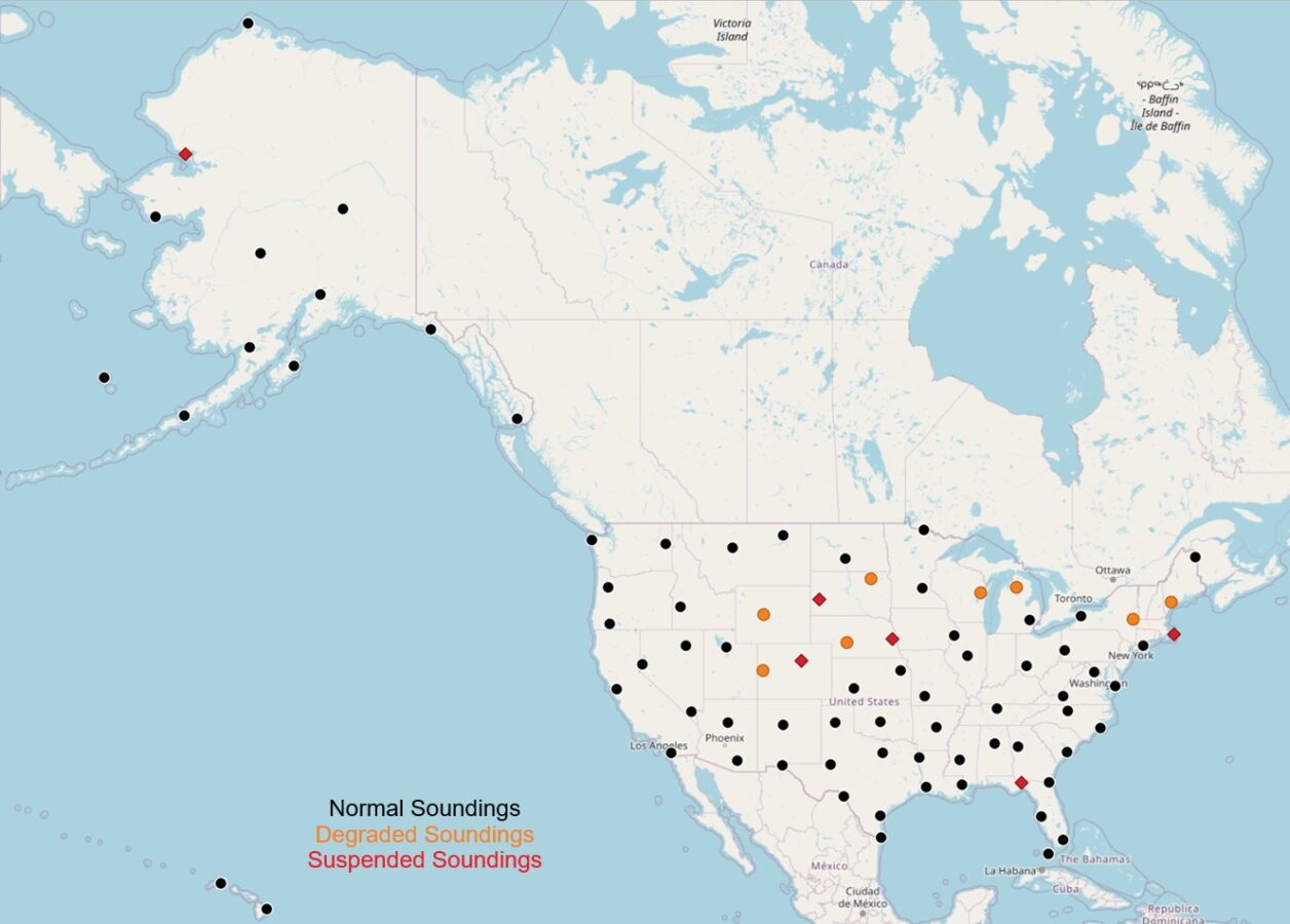
On February 27, 2025, over 1,000 employees at the National Weather Service (NWS) were illegally fired by the Trump Administration under the premise of “making the government more efficient,” even though the agency was already severely understaffed. That same day, due to the job losses, weather balloons were suspended at the NWS Office in Kotzubue, AK. But it didn’t end there. On March 7, Albany, NY and Grey, ME announced partial suspension of their weather balloon launches. And just last week, on March 20, NWS offices in Omaha, NE and Rapid City, SD announced the suspension of their weather balloons. Six other NWS offices in states like Nebraska and Wisconsin revealed a reduction in weather balloon launching capacity that same day.
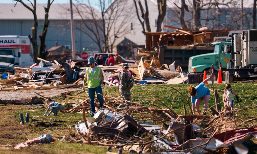
This might not sound like such a big deal, but as we’re gearing up for tornado season, which peaks between April and June, taking weather balloons offline in the Heartland of the United States, also known as Tornado Alley, will directly affect the NWS’s ability to predict severe weather, including tornado-producing thunderstorms. This could lead to more severe weather-related deaths that could have otherwise been avoided.
Why do weather balloon observations matter?
Weather balloons are a critical piece of the NWS’s observations infrastructure and have been for nearly a century. They carry radiosondes, instrument packages that report back temperature, pressure, wind, relative humidity, and GPS data to NWS offices, giving us a three-dimensional view of the atmosphere. In the United States, there are 92 NWS locations that release weather balloons, providing data to the NWS and their weather forecasting models.
Weather models use data collected by weather balloons
But why do we care about what’s going on in the upper atmosphere? Well, first of all, this data is invaluable for our weather forecasting models. As you may know, meteorologists use weather models to help predict what will happen to the atmosphere in the future. Models anticipate things like winter storms, severe weather outbreaks, flood-inducing rains, or conditions favorable for wildfire development.
For a weather model to predict the future, it needs an accurate representation of what’s currently going on in the upper atmosphere. By suspending weather balloon launches at multiple locations, we lose data for the weather model, leading to a decrease in its predictability that negatively affects daily forecasts and outlooks for extreme weather events.
In fact, out of eight types of observations by the NWS (including airplanes and station observations), weather balloons are the second most important in improving prediction of weather models. They also only cost about $10 million per year to launch (assuming each balloon is $200), compared with the total cost of GOES-R satellite—another critical piece of the NOAA observations infrastructure—of $350 million per year. Weather balloon launches are so useful for the prediction of severe weather events that NWS offices often launch more than the usual 2 balloons per day to better inform modeling of a potential tornado outbreak.
Knowing what’s going on in the upper atmosphere could save lives
Weather models aside, if we know what’s going on in the upper atmosphere, it makes weather forecasting in general a lot easier in the short-term. What goes on in the upper atmosphere is reflected by weather conditions at the surface.
Imagine you live in central Oklahoma and wake up one morning in mid-May. For the past several days, the NWS and their weather models have been predicting the possibility of a tornado outbreak to the east of where you live. However, observations retrieved by a weather balloon launch that morning revealed favorable conditions for a tornado outbreak to start where you live, rather than to the east of you.
Immediately, the NWS issues a tornado watch for your area, and you and your neighbors prepare for a potential tornado later that day. So, yes, the models were slightly wrong, but at least the NWS was able to provide some prep-time given the observations collected by the weather balloon that morning. If the NWS didn’t release a weather balloon, they may have missed the impending tornado outbreak, and you and your neighbors would have been caught completely off guard.
Ok, it sounds like I’m exaggerating, right? Actually, not at all. On October 3, 1979, a devastating F4 tornado struck Windsor Locks, CT with no warning. According to a study in 1987, the lack of warning was determined to be due to a lack of upper atmospheric data (no nearby, timely weather balloon launches), which led to an underestimation of the strength of the thunderstorm that produced the tornado.
Three people lost their lives in that tornado. It’s not science fiction to say that more people could lose their lives in the future given a lack of observation of the upper atmosphere. Because of this, and especially as we head into peak tornado season, it is critical for the NWS to remain fully staffed and fully funded. American lives are on the line.